When performing a terrain survey, two major factors need to be considered: accuracy and speed. We performed terrain surveys using two different methods in order to see how each method performed according to these factors.
Study Area:
The point collections were performed in the UW - Eau Claire campus commons (Figure 1).
 |
| Figure 1: Our study area. |
Methods:
The first point collection was using Real-Time-Kinematic GPS (RTK). RTK allows for extremely high positional accuracy, as it is constantly getting a correction signal via an internet connection. The internet connection was provided by a Verizon MiFi, which allowed us to collect using a corrected signal regardless of our location. The points were recorded with a Topcon Tesla, which was connected to a Topcon Hiper SR. When we collected points, we had the receiver collect 10 positional points at every collected location.
 |
| Figure 2: Casey using RTK to record the "backsite" point while David shivers while holding the prism rod. |
The second point collection method was Total Station. Total Station works as an advanced form of distance azimuth survey. If the distance and azimuth between a known point and another location is recorded, it is possible to determine the location and elevation of the location. First, two points needed to be collected using RTK, with one of the points where we were to set up the total station ("occupied point"), and the second point ("backsite point") at another location. Next, we set up the total station over the first point, so the center of the tripod was over the collected point's location. After the tripod was in the proper location, it needed to be leveled, so the points would all be collected accurately. After the total station was leveled, we fired the laser at the second RTK point in order to calibrate the total station's azimuth and distance readings. This is called "shooting the backsite". After the system is calibrated, points were recorded by having a person hold the prism rod while a second person fires a laser into the center of the prism. The distance and azimuth recordings from the laser were recorded by the Topcon Tesla.
Results:
When the positions of all 10 points were averaged, the RTK had horizontal accuracy of ~3mm and vertical accuracy of ~4mm. The RTK rig needed to be leveled before every point could be collected, greatly slowing the collection process.
Using Total Station to conduct a survey was slightly slower, because of the time required to set up the tripod and level the sensor. However, once these were done, it was possible to record points substantially quicker than with RTK, as there were no limitations as a result of poor GPS fixes.
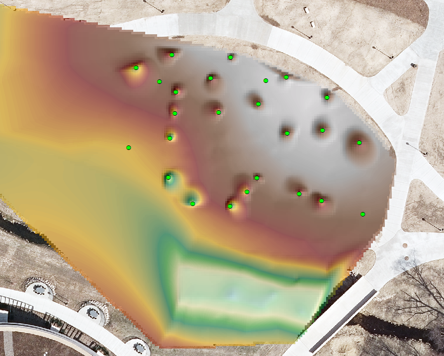
The surfaces generated from the points provided a good representation of the natural environment, and didn't have any outlying points (Figure 3).
 |
| Figure 3: Points collected with RTK are symbolized in green, and points collected with Total Station are symbolized in blue. |
 |
| Figure 4: The inaccurate points are symbolized in bright green. |
Conclusions:
Both methods allow for accurate data to be collected, and will be very useful for conducting future terrain surveys. I will probably use RTK when collecting GCPs and other highly accurate points at lower spatial densities. Total Station will be used when collecting points at higher spatial densities, as it allows data to be collected at a much higher pace.
No comments:
Post a Comment